Samara University has completed developing new digital services for building a “digital twin” of the region. The products help improve the quality of strategic territorial management. The services are based on computer software systems for processing big data. They are obtained from the Earth remote sensing systems. According to the University’s staff, the information obtained from space satellites is structured and analyzed by using artificial intelligence technologies.

Today, geodata-based services are needed in various sectors of the economy: urbanism and urban development of territories, natural resource development and agriculture, cartography and navigation, transport and nature-disaster monitoring.
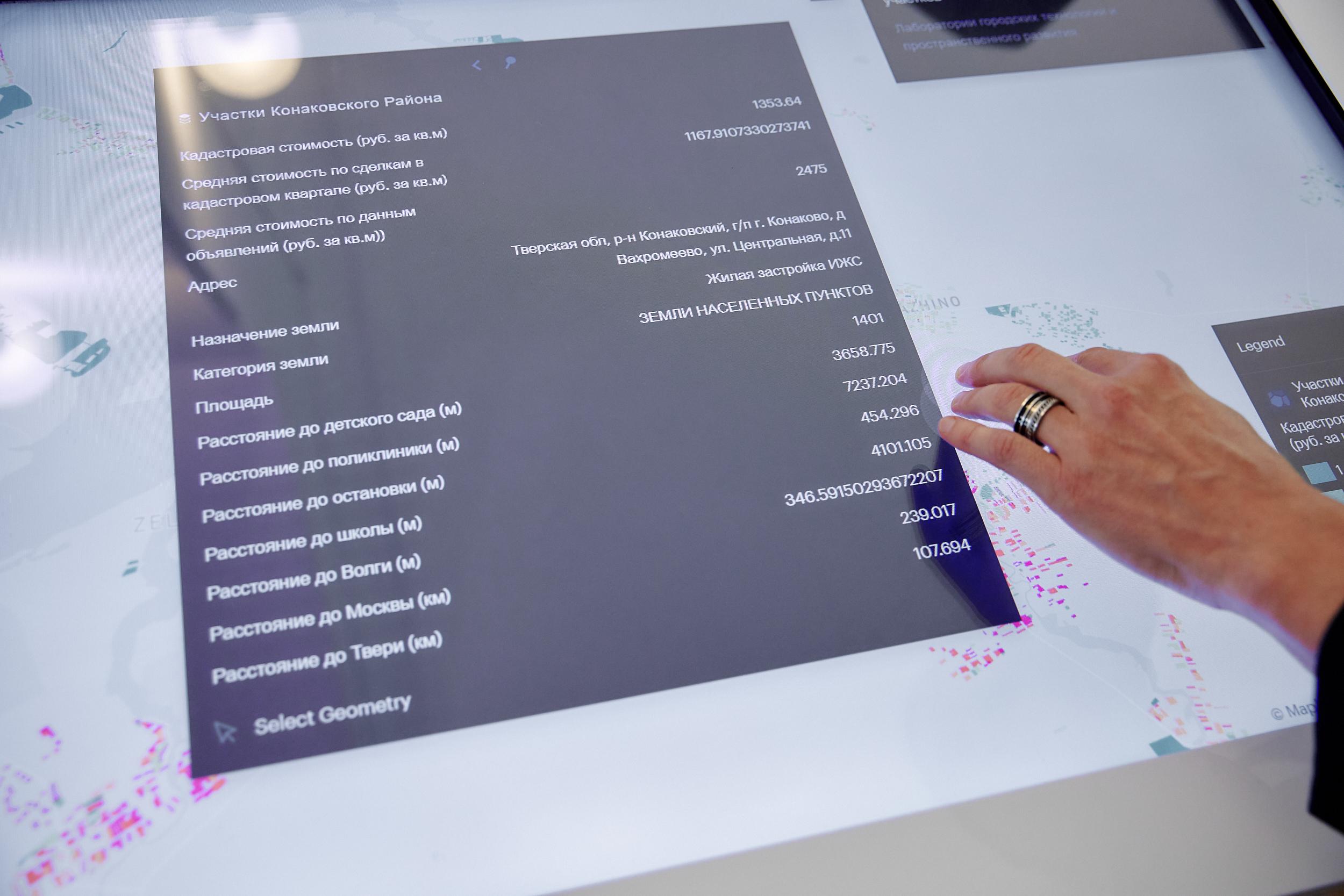
One of the new services developed at the University is called “robotic cartographer”. The software based on satellite and aerial photographs creates digital profiles of real estate facilities.
Next, the service generates for the territory its address plan with several “layers” of information. This allows for a multi-purpose analysis of urban areas. For example, the service defines the purpose of buildings, calculates the number of residents, and evaluates the transport accessibility of the location. These data facilitate accurately planning the territory development, given the population density and the infrastructure availability in the area. The “robotic cartographer” has already started to be used in Samara, for spatial planning and improving the urban environment. In particular, recommendations given by the service became the basis for adjustments to “Socioeconomic Development Strategy for the Period up to 2025”. It should be recalled that this document defines priorities of public administration in the long term.
On the basis of the “robotic cartographer”, scientists have developed another service – “land inspector”. It automatically detects violations of the land legislation in the territories. The software program processes the data from various systems, such as the Unified State Register of Real Estate Facilities. The information is compared with satellite images. For example, the system is able to detect if commercial real estate – a store or a car repair shop – has been illegally built on a site allocated for individual housing construction. Such a violation often means that the owner of the property incorrectly pays the tax for the land plot. The service can transmit the information to the tax authorities that then initiate auditing and charge additional tax to the land-plot owner.
This service has also already been implemented in a number of municipalities of the Samara Region, which has improved land control and increased the tax base. According to the University, during the period 2023–2024 alone, the use of the “land inspector” in the region, the additional taxes and fines amounted to over 90 million rubles.
At present, the service has been launched at the federal level, able to analyze data on land plots in almost all regions of Russia. The estimated economic effect from using the software program over the country is estimated at more than 30 billion rubles, which will be transferred to budgets after accruing additional taxes.
Another unique product developed by the University’s specialists is designed for remote monitoring of natural and anthropogenic objects. Forest areas, farmland, lands near quarries, roads, and buildings can be evaluated by the software program according to a number of criteria. In real time, spacecraft or unmanned aerial vehicles check the intended and regulatory use of these objects, and their compliance with safety requirements.
The system uses technologies, such as computer vision, artificial intelligence, and geoinformation modeling. If the software program identifies potential risks or violations at the objects, the operator receives an alert, which often prevents dangerous situations.
The University’s third project involves creating a digital model of the “night” population, accurate to a house. The tool shows how many people actually live in each house, without considering their daily movements, what is their gender and age composition. The system can also predict how the population of the territory will change in the next five years. This digital model is highly accurate. For example, previously existing similar technologies could model the demographic situation only based on the cells of the quarterly grid.
The new services developed at the University will accelerate introducing the digital twin technology in the Samara Region and other regions. It means a thematic computer model defining the development options for a particular territory. And if earlier territory planning was based on the expert approach of the professional community, then due to digital twins, the scenarios can be formed following the clear system of indicators.
Today, some components of “digital twins” are already operating in the Samara Region. Among them, there are the system for comprehensive monitoring and control of violations of the environmental and land legislation, as well as services for detecting tax arrears.
It is expected that the University’s developments will also help analyze and plan developing territories, taking into account their location and parameters.
“Samara-Informsputnik” JSC is the University’s industrial partner in creating digital services. The company develops geographic information systems for the regions of the Russian Federation. As explained by Andrey Chernov, Senior Researcher at Samara University’s Research Laboratory of Geoinformatics and Information Security, Deputy General Director of “Samara-Informsputnik” JSC, the region is interested in introducing “digital twin” services. “We cooperate with the government, the Ministry of Digital Development, and the Ministry of Urban Development Policy recently established in the Samara Region. It is possible that in future, the University's digital models will be used for preparing territorial planning documents, for example, master plans. Today, it is obvious that such documents need to be regularly adjusted to take into account demographic and other changes. “In this case, the “digital twin” of the region provides the most objective scenario for developing the territory, as well as predicts the load on its transport and social infrastructure. The “digital twin” can also estimate changed in the dynamics of prices for built real estate. All these features improve the quality of planning”, explains Andrey Chernov.
Resources for science
Samara University’s scientific school in the field of geodata processing and remote sensing of the Earth is one of the most experienced and reputable in the country. The University’s scientists have been working on developments in this area since 1998.
In 2022, it became known that the University would receive federal funding to continue the research on geodata processing. The University joined the country’s consortium of scientific, educational and engineering organizations, which, together with Moscow State University of Geodesy and Cartography (MIIGAiK), will develop geoinformation technologies. The work was funded under the government program “Scientific and Technological Initiative” (STI). The program is aimed at achieving Russia’s technological leadership in the global market.
A grant from the federal budget was allocated for implementing the consortium members’ research and development activities. Samara University received part of the grant.
The University’s research was conducted by the Department of Geoinformatics and Information Security. When allocating the grant, the experience and competencies of the regional university were considered. Thus, the Department has the specialized research laboratory furnished with special equipment: systems for receiving and processing space data, information security systems, as well as the hardware and software complex for storing and analytically processing unstructured data.
According to Andrey Chernov, receiving the federal grant accelerated the work on digital services. “The University conducts research in the field of geodata through several sources of funding, while the grant from the NTI Support Fund was not the main one. The largest share of the funds is provided by our industrial partners. Nevertheless, participating in the consortium has facilitated scaling new projects and offering them to other regions”, said the University’s representative.
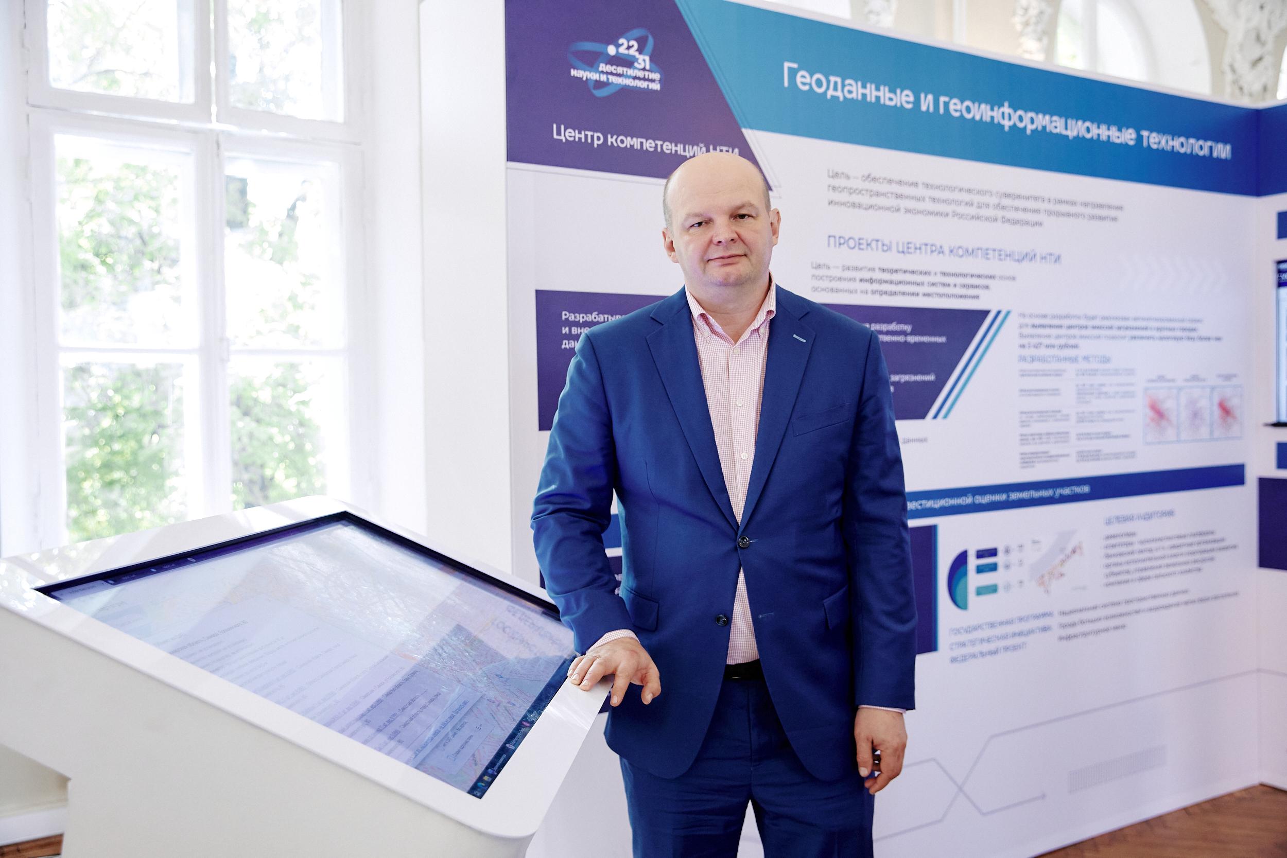
Andrey Chernov, Senior Researcher at Samara University’s Research Laboratory of Geoinformatics and Information Security, Deputy General Director of “Samara-Informsputnik” JSC
Today, “digital twin” is a rather vague concept. By this, we mean a model capable of “looking into the future” and solving the tasks of managing territories by applying the “if – then” principle. So, when planning, the “digital twin” calculates the possible effect of urban planning changes. As a rule, previously these tasks were solved by expert urban planners or industry experts, but now they are shifted to artificial intelligence.
Source: kommersant.ru