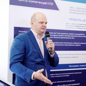
According to the project authors, introduction of the service has already brought considerable economic benefits: due to “Robot-Cartographer” implemented as part of the Integrated Remote Monitoring System of the Samara Region, over 110 million rubles have been found and additionally accrued as tax revenues and fines for land violations detected by the “robot” since 2022 to the present. This was told about by Andrey Chernov, one of the key developers of the service, Senior researcher at the Research Laboratory of Geoinformatics and Information Security of Samara University, during the presentation of the activity results of the NTI Competence Centre. “Together with MIIGAiK, we currently carry out a large amount of work combined into several projects. Our main idea is to include digital maps and the Earth remote sensing data not just in the contour of monitoring tasks, but in the contour of tasks of managing a specific territory. Many developers try to do this, but almost no one has managed to implement it at the system level yet. Our system makes it possible to automate control and supervisory activities of authorities, automatically detecting probable violations related to various facilities – buildings, land plots, for example. Neural networks and artificial intelligence algorithms combine and compare the Earth remote sensing data with data from different databases, while highlighting those that do not coincide, after which they independently draw conclusions. For example, in the Samara Region, due to our service, since 2022 to the present, about 35 thousand facilities of individual housing construction have been identified as those without cadastral registration. Because of their registration, the planned tax increase has already amounted to over 80 million rubles, and not all the identified facilities have been registered yet, i.e. this amount will grow in future. Besides, there are identified land plots to be taxed at an erroneous tax rate, and the economic effect after adjusting the rate amounted to about 30 million rubles more”.
According to Andrey Chernov, the activity coverage of the Samara “Robot-Cartographer” already includes all Russian cities with their population of over 100 thousand people. The generated digital models and profiles of territories and facilities in these cities are constantly updated and advanced. Next year, it is scheduled to start working on small towns and villages with their population of over 10 thousand people. In this way, it will gradually be possible to generate digital models of almost all settlements in the country. For instance, the Samara region has already been completely digitized.
The developments created in Samara, in collaboration with the Consortium organizations related to geodata and geoinformation technologies, can also be used for automated and even automatic updating of digital maps. The neural networks quickly detect missing buildings, facilities with incorrect addresses, or double facilities with the same address located in different places on the address plans of cities. Using data from satellites or UAVs, the comprehensive remote monitoring system can automatically detect various forest modifications (including illegal logging), unused agricultural land, landfills and quarries beyond their boundaries permitted. Moreover, the system can not only identify violations, but also prescribe penalties to responsible officials and organizations (if they can be determined) in accordance with the norms of the legislation introduced.
Another important application of such technologies is creation of digital twins of cities, towns, and districts, for the purpose of forecasting their future development. By downloading the necessary data, it will be possible to predict, for example, how construction of the international interuniversity campus to be built near the Solidarity Samara Arena stadium will affect development of Samara.
“If there are the geodata database, various-type models build on its basis, and, most importantly, indicators to determine the success of a particular territory, then, accordingly, we can play on these models various options for the territory development. For example, what happens if something – a shopping centre or an entire micro-district – is built in this or that place. What will happen to real estate prices, transport accessibility, how the population composition will change, whether there will be enough existing schools, kindergartens, and so on. Thus, we can use technology to look a little into the future”, said Andrey Chernov.
For reference:
- In 2022, the “Robot-Cartographer” project became a prize-winner in the “Problem Analysis” nomination of the competition on application of the evidence-based approach to management decision-making, held by the Accounting Chamber of the Russian Federation. The replicated software of the project has shown its efficiency in solving tasks facing local governments. Besides, in 2022, due to the project, the Samara Region won the first prize in the 10th All-Russian Competition “PROF-IT”.
