

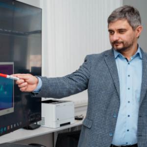
Scientists at Samara University have developed Russia’s first web service for the automated, AI-driven processing and analysis of hyperspectral data acquired from unmanned aerial vehicles (UAVs) and spacecraft during Earth observation.
Hyperspectrometers are devices that perceive reality through multi-channel spectral imaging, allowing them to detect objects invisible to conventional observation tools. Hyperspectral data inherently consists of massive information arrays, the analysis of which traditionally requires significant time and substantial computing power.


Registered users of the new service can upload hyperspectral data to a specialized online platform and perform various operations using built-in tools, including artificial intelligence. Currently, the service is undergoing closed beta testing with organizations and enterprises that utilize hyperspectral Earth remote sensing data.
"At Samara University, the Second-Wave Artificial Intelligence Center has created and launched the HS-View Monitor web service. This is an effective and unique working tool for processing and analyzing hyperspectral Earth remote sensing data obtained from space (satellites) as well as from UAVs. The service integrates data viewing, preparation, classification, and the training of neural network models into a seamless workflow. The final thematic layers are placed on a digital map, allowing analytical results to be correlated with the spatial context of the studied territory. This virtual tool, which accelerates and simplifies processing and analysis, will undoubtedly be valuable to researchers and consumers of hyperspectral data—organizations and enterprises operating across various sectors of the domestic economy. For now, it is the only web service of its kind in our country," stated Professor Artem Nikonorov, Director of the Institute of Artificial Intelligence and+ Head of the "Intelligent Mobility of Multifunctional Unmanned Aerial Systems" Center at Samara University.
As the scientist emphasized, users of the service have access to a wide range of tools, from basic processing and spectral analysis to the ability to apply previously created data processing scenarios to other geographical regions. Another crucial aspect is the complete localization of the web service within Russia; all data is stored and processed exclusively on servers located within the country.
"The service is currently being tested in a closed mode, and we are gathering feedback and recommendations to supplement and improve the platform's functionality. For instance, we plan to add several atmospheric correction modules for hyperspectral Earth remote sensing data in the future. Among the test tasks currently being performed by the service are oil spill monitoring, vegetation and soil mineral composition analysis, water body purity control, weed recognition, and much more. The testing phase is expected to last for several months," noted Artem Nikonorov.
For Reference:
Samara University is one of the global leaders in photonics and possesses significant expertise in the development of hyperspectral technologies. The university's scientists have created advanced, compact hyperspectrometers that operate successfully both in space and on Earth.
During hyperspectral imaging or hyperspectral Earth remote sensing conducted via UAVs or space satellites, each pixel of the resulting image is represented as a full or continuous spectrum. This allows for the identification of the spectral properties of target objects and, through data analysis, the detection of objects that cannot be seen using other observation methods.
For example, hyperspectrometers can effectively detect greenhouse gases by capturing methane and CO₂ emissions, as well as conduct geological exploration in hard-to-reach areas by identifying the spectral signatures of various minerals from space, including those indicating potential oil and natural gas deposits. Furthermore, hyperspectrometers monitor the health of forests and agricultural crops with higher quality and precision, help calculate vegetation indices, and can even detect plant stress from space.
