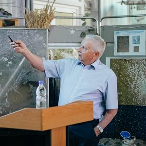


“Perhaps, you’ve heard the song called Attraction of the Earth. It is about the emotional attraction — we are all children of our beautiful planet, after all. There are increasing talks about the physical attraction of the Earth though. About gravitation. However, aside from attraction of the Earth, there is also reflection: the planet can tell us about itself if we use the proper means. Today I would like to tell you about these means and I sincerely hope it will provoke your interest,” Soifer told the pupils.
As soon as people learnt to rise above the Earth, the started capturing what could be seen from above: at first, from an aerostat, then from the plane and, finally, through the window of the spaceship. The first photos of the planet from the orbit were made by our second spaceman German Titov who, by the way, visited Samara University a couple of times. Then “orbital photo cameras” were launched to the space — space-based imaging systems for surveillance or Earth remote sensing satellites, as they are called now.
Emergence of those satellites in our country was associated specifically with Samara (then — Kuibyshev). They were designed in the early 1960s by the Central Specialized Design Bureau under supervision of Dmitry Kozlov, a Chief Designer. It was here, at the Progress plant that the manufacturing of Earth remote sensing spacecrafts was arranged (now those two organizations are united into the Progress Rocket Space Centre). Dmitry Ilyich made a large contribution into development of Samara University. The department he founded and led now keeps his name.
The presentation slides go one by one; Viktor Soifer talks about the capabilities of the modern Earth remote sensing spacecrafts, the industries that nowadays are unimaginable without space monitoring. These include meteorology, hydrology, ecology, agriculture and forestry, natural resources development, topography, development of cities and any urbanized territories in general, control over the transport systems, military intelligence...
The key question is: what do consumers of today’s space images need? High spatial resolution, accurate picture linking to the location, promptness, spectral resolution — all these are listed by the academician.
“Let’s take precision agriculture — this task requires a very high spatial resolution. It’s about dozens of centimeters. Spectral resolution also means a lot for consumers, since every chemical element has its own spectral response. And, finally, promptness. When looking at Google maps or Yandex maps, we can see that they are often one year too old. Meteorologists need the promptness of no longer than an hour for a high quality forecast. The humanity moves toward non-stop space-based surveillance. In 1957, there was the only Soviet satellite on the orbit, and now there are dozens of them,” — Viktor Soifer continues.
He also shared why images made from the orbit cannot be used without serious and deep procession. What can be seen when looking beyond the border of the visible portion of spectrum, when “slicing” the spectrum into tens or even hundreds of narrow spectral ranges and combining them in a picture. Another huge challenge is to create a uniform base of “space” data on the Earth.
‘It’s one of significant issues. An incredibly powerful server is required. A huge data storage. Serious search algorithms are needed. It’s the task for the future. There is a large room for work for those that want to be involved in information technologies, artificial intelligence,” Viktor Soifer emphasized.
His speech concluded the series of five lectures on scientific ideas and developments in the field of Earth remote sensing. On May 19–26, scientists from the Samara University spoke in front of the schoolchildren. The speakers were practitioners that designed hyperspectral optics, created neural networks for image processing as well as geo-informational systems using space images of the Earth. Their speeches gathered together over 300 schoolchildren.
The series of lectures launched the Korolev’s School project implemented by the University together with the Innovation Promotion Fund. As early as the next week the educational intensive on 3U/6U CubeSats with Hyperspectral Cameras is to be launched to take place in Samara University on June 5–9.
Each of five schools included in the project selected five pupils from 7–10 grades to get trained in accordance with a specially designed program. These 25 schoolchildren will get an opportunity to work in University laboratories, meet famous scientists, go to tours and lectures, and participate in academic and entertainment events prepared by the students of Samara University.
The project doesn’t end on the educational intensive. It will be continued in autumn, as soon as a new academic year starts.
For reference:
Korolev’s School Educational Intensive
It is an educational project for senior high school students of the Samara Region that Samara National Research University implements in the framework of the grant “Material and Technical Support of Teaching Package Development based on a Hyperspectral Camera of High Resolution and the Cubesat spacecraft for issues of Earth remote sensing” provided by the Innovation Promotion Fund, as well as in the framework of the University program “Development and Implementation of the Additional Academic Program for Project Work with Schoolchildren using the Actual Load of the satellite platform “3U/6U CubeSat with a Hyperspectral Camera” (included in the Priority-2030 Federal Program).
The project covers five general education establishments of the Samara city district:
- Samara International Aerospace Lyceum;
- Samara Medical and Technical Lyceum;
- Aerospace Lyceum No. 135;
- School No. 26 named after D.I. Kozlov;
- Private general educational institution Lyceum No. 1 “Sputnik”.
Lecturers and their subjects for senior high school students:
- Viktor Alexandrovich Soifer, member of the Russian Academy of Science, Doctor of Engineering, Professor, President of the Samara University.
Subject: Reflection of the Earth;
- Roman Vasilievich Skidanov, Doctor of Physics and Mathematics, Professor of the Department of Engineering Cybernetics.
Subject: Hyperspectral Methods or Hundreds of Light Shades;
- Vladimir Vladimirovich Podlipnov, Junior Research Associate, RDL-602 (Research and Development Laboratory “Photonics for Smart Homes and Smart Cities”), Senior Lector of the Department of Engineering Cybernetics.
Subject: Earth Remote Sensing, Spectral Monitoring of Earth and Space, or Hundreds Shades of White.